

Aerial data you can build on.
UK drone surveying, measurement and inspection
Topographical surveys, stockpile volumes, inspections and progress media, captured in-house and delivered as plans, models and reports you can use.
Four ways we turn flights into site intelligence

Digital topographical surveying
Whole sites captured in a day and delivered as plans, contours, point clouds and 3D models.
TOPO PLANS CONTOURS POINT CLOUD CAD / GIS
Explore surveying

Volumes, grades & tonnages
Stockpiles, earthworks and landfill cells measured from survey data: repeatable, auditable, fast.
VOLUMES CUT & FILL LEVELS CHANGE OVER TIME
Explore volumes

Drone inspections
Roofs, structures and hard-to-reach plant inspected in high-resolution detail, without scaffolds or work at height.
ROOFS STRUCTURES CONFINED SPACE DEFECT RECORDS
Explore inspections

Media & project progress
Broadcast-quality photography, video and repeat progress records from consistent viewpoints.
PROGRESS PROMO VIDEO BEFORE / AFTER STAKEHOLDER UPDATES
Explore media
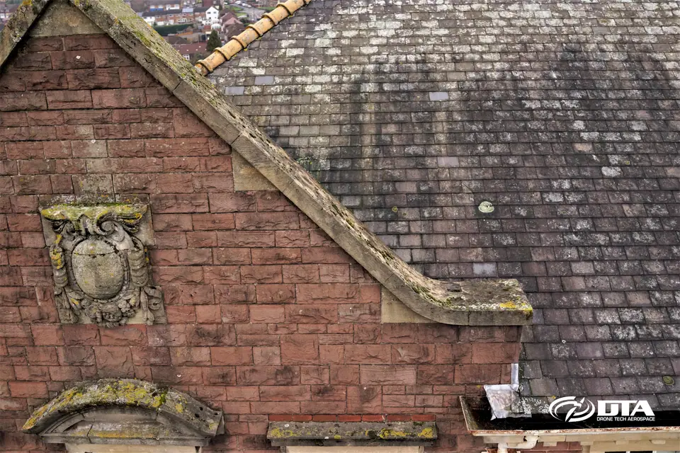
The aerial data behind building condition reports
We partner with building surveyors across the UK, capturing high-end roof and elevation detail their condition surveys depend on.
You keep the client and the professional judgement. We supply the evidence.
Building condition surveysFrom enquiry to usable data
-
STEP 01
Scope & quote
Tell us the site and the outputs you need. We confirm scope and price (free, no obligation).
-
STEP 02
Plan & permissions
Flight planning, site liaison, risk assessments and any airspace permissions handled by us.
-
STEP 03
Fly & capture
Our own pilots capture the site, typically in a fraction of the time ground methods need.
-
STEP 04
Process & deliver
Data processed into the plans, models and reports your team can use straight away.
What you actually receive
Real outputs from real projects, not promises. Every deliverable arrives in formats your CAD, GIS or BIM workflow already uses.

Orthomosaic imagery
A single, measurable top-down image of the whole site.
Georeferenced · print & GIS ready
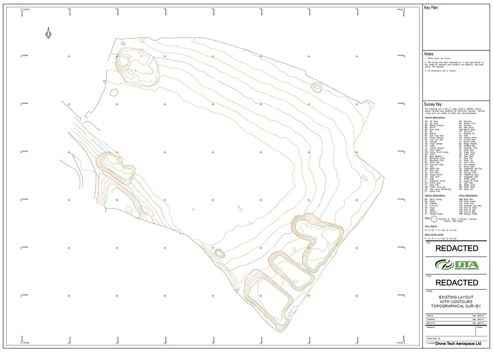
Topographical plans & contours
Traditional 2D drawings your engineers can design from.
CAD formats · levels & features
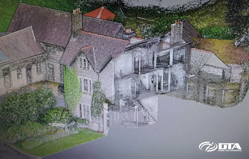
Point clouds
Dense 3D measurement data for design, BIM and analysis.
Aerial + terrestrial merge
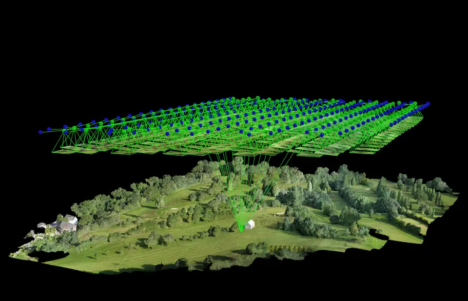
3D site & terrain models
Digital terrain and surface models, plus interactive fly-throughs.
DTM / DSM · model fly-through
Volume reports
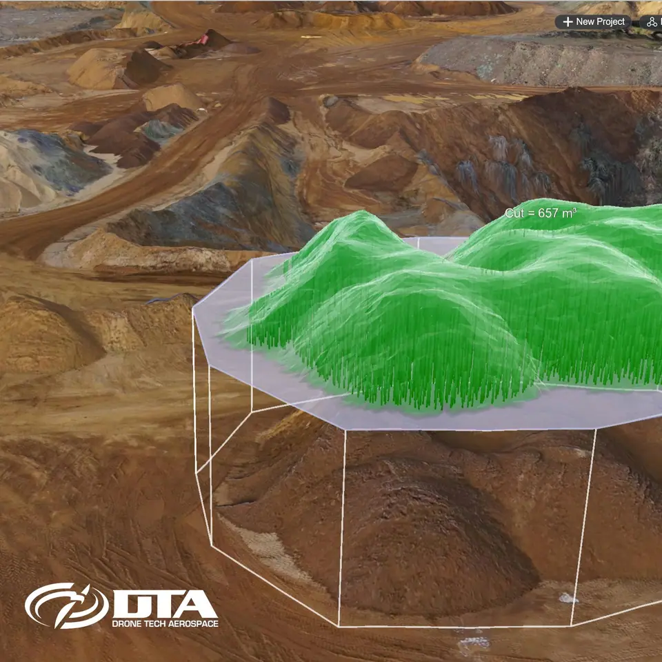
Stockpile and earthworks quantities, comparable survey to survey.
Volumes · levels · change

CAD & GIS outputs
Standard interchange formats used across surveying and civils.
Industry-standard formats
Trusted on the UK's biggest sites
- On HS2
- 6+ years
- greenfield surveys to viaduct completion
- Largest survey
- 2,600 ha
- believed the UK's largest by drone
- Operating since
- 2014
- owned and run by its two directors
- One campaign
- 144 roofs
- inspected in Central London in 2 months
"The outputs provided from the survey exceeded our expectations with a significant level of detail and accuracy."

A topographic survey, start to finish
A walkthrough of a drone topographical survey, from capture to deliverable.
Trusted by
From tier-one contractors to national utilities


Built for your sector


UK-wide, with our own pilots
We fly across England, Wales and Scotland with in-house pilots and survey technicians, never white-labelled subcontractors.
We've been surveying nationwide since 2014, with our heaviest coverage along the M4 and M5 corridors.
From our Cardiff, Wiltshire and West Wales bases, we plan and deliver work across England, Wales and Scotland, including controlled-airspace and multi-site programmes.
Coverage excludes Northern Ireland at present.
Cardiff HQ
2 Alexandra Gate, Ffordd Pengam, Cardiff CF24 2SA
Wiltshire
96 Curlew Drive, Chippenham SN14 6YQ
West Wales
Cwch Gwenyn, Llandeloy, Pembrokeshire SA62 6LJ
Strongest coverage
- London
- Cardiff
- Bristol
- Bath
- Cheltenham
- Gloucester
- Worcester
- Birmingham
- Swindon
- Salisbury
- Oxford
- Reading
Tell us about your site.
Send the location and what you need. We'll come back with a clear scope and price.
Or we call you