

Construction · civil engineering · infrastructure
Construction site drone surveys
Give design, commercial and project teams a coordinated site view: topographical data, earthworks quantities and repeat progress records.
Facts panel
- Survey outputs
- Orthomosaics, topographical plans, contours, point clouds and terrain/surface models.
- Quantity outputs
- Stockpile volumes, cut and fill, levels and change between surveys.
- Progress outputs
- Repeat photography, video and fixed-viewpoint records.
- Project stage
- Feasibility, enabling works, earthworks, build progress and as-built record.
Working on a materials-heavy site? Quarry, earthworks and stockpile volumetrics are a related DTA service.
Explore quarry drone surveysData the whole project team can use
A construction site changes quickly. DTA captures a dated, measurable record and supplies the outputs required by the team, rather than treating aerial photographs as the final product. Where several outputs can be captured safely in the same visit, DTA scopes them together.
- Engineers: CAD and terrain data from drone surveying
- Commercial teams: agreed quantities
- Project managers: comparison across survey dates
- Communications teams: planned progress imagery
From greenfield baseline to completion
DTA's work with Align JV at Denham and the HS2 Colne Valley Viaduct began in 2019 before the first ground was broken. It started with topographical land surveying for baseline design and planning data and developed into regular photography and video for progress monitoring and public relations through to viaduct completion.
That sequence demonstrates the value of planning the record around the programme: early measured data, consistent repeat capture and an archive that remains intelligible years later.
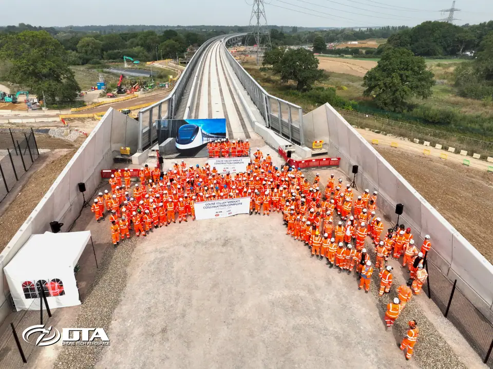
HS2 Colne Valley Viaduct, deck completion
DTA's drone record of the viaduct's final deck section, completed in August 2025.
Typical construction applications
Pre-construction
- Pre-construction topographical and land surveys
- Enabling works and existing-condition records
Earthworks and infrastructure
- Earthworks, cut-and-fill and stockpile quantities
- Corridor and infrastructure surveys
- Point clouds and models for design coordination
Progress and completion
- Monthly or milestone progress capture
- Fixed-viewpoint stakeholder imagery
- As-built or completion records within the agreed survey scope
A repeatable survey programme
At mobilisation, agree the survey boundary, control, coordinate system, outputs, naming convention, comparison method and site access process. For progress media, agree repeatable viewpoints, camera direction and project milestones. Each visit should then produce a dated package with the same structure. That consistency makes the archive easier to compare, verify and hand over.
- Survey boundary and control
- Coordinate system and naming convention
- Comparison method and site access process
- Repeatable viewpoints and camera direction
Planning around a live site
Risk assessments and method statements are part of the operation. The project programme and site rules determine when and how capture can take place. DTA plans flights around:
- People and plant
- Lifting operations and temporary works
- Access and airspace
- The principal contractor's site controls
DTA has supported the construction and civil engineering sector for 6+ years, from early greenfield surveys through to viaduct completion.
Send us these six things
-
01
Site location / boundary
-
02
Required output
-
03
Intended use
-
04
Preferred timescale
-
05
Access / airspace constraints
-
06
Any existing drawings
Common questions
Can one visit provide survey data and progress media?
Often, yes, but the capture patterns and quality requirements differ. DTA will confirm whether both outputs can be collected safely and efficiently during the same mobilisation.
Can the survey fit our project coordinate system?
Provide the coordinate reference, control information and required deliverables at quotation stage. The team will scope the control and processing required for the intended use.
Can you repeat the same views every month?
Yes. Agree fixed viewpoints and framing at the start, then retain them as part of the project capture plan. Weather, access and site change may require a documented adjustment.
See it in practice
12 August 2025
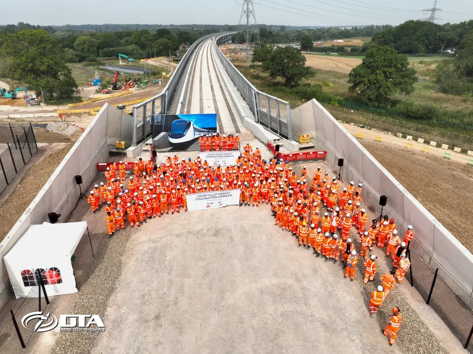
Align JV (HS2) Colne Valley Viaduct Completion
DTA has worked with Align JV on the HS2 Colne Valley Viaduct since 2019, from initial topographical land surveying through to drone photography and video marking the viaduct's completion.
9 April 2019
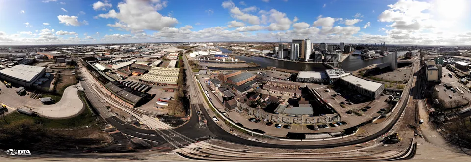
5.5 Km Long Construction Site Drone Video, Manchester
DTA filmed a drone video covering the entire 5.5 kilometre length of a Manchester tramline construction site for a Tier 1 construction client, updating progress as the project neared completion.
9 August 2019
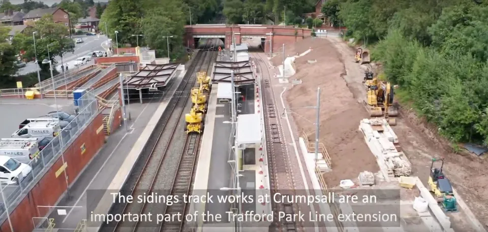
Drone Video Services for the Transport for Greater Manchester Metrolink Project
DTA supplied the third periodic drone filming update for Transport for Greater Manchester's Metrolink Trafford Park Line extension, part of a growing programme of construction PR and progress-monitoring video work.
Plan the survey around the programme
Send the site boundary, project stage, required outputs, coordinate information, visit frequency and site constraints. DTA will propose a practical survey and delivery schedule.
Request a QuoteTell us about your site.
Send the location and what you need. We'll come back with a clear scope and price.
Or we call you