

Quarries · aggregates · stockpiles · faces · benches
Quarry drone surveys and volumetrics
Capture the working site quickly and turn it into topographical, surface and volume data for reconciliation, earthworks and extraction planning.
Facts panel
- Survey
- Site topography, faces, benches, voids, levels and access routes.
- Measure
- Stockpile volume, cut and fill, remaining airspace and change over time.
- Deliver
- CAD plans, contours, orthomosaics, point clouds, surface models and volume reports as scoped.
- Repeat
- Use consistent boundaries and control so reporting periods can be compared.
Need the site plan as well as the stock? Quarry surveys are part of DTA's wider topographical surveying service.
Explore drone surveyingOne capture, several site decisions
A planned aerial survey can cover the active quarry and its material stocks without asking a ground team to walk every face and pile. The same dataset can support a topographical plan, stockpile calculations, surface models and a visual record of current conditions. DTA agrees these points before flight so the output is auditable and useful to the people reconciling quantities, planning work or updating drawings.
- Site boundary
- Coordinate system and control
- Deliverables
- Volume bases
What can be surveyed?
Stock and extraction
- Stockpiles and spoil heaps
- Extraction faces and benches
Site surface
- Quarry floors, ramps and haul roads
- Cut-and-fill areas
Capacity and change
- Voids and remaining capacity
- Restoration areas and changing landform
- Fixed features required on the topographical plan
Vegetation, standing water, deep shadow, active operations and inaccessible ground can affect the surface that can be reconstructed. These constraints should be discussed at scoping rather than hidden in the final report.
Volume is measured; tonnage is estimated
Volume is calculated between the surveyed material surface and an agreed base or reference surface. Tonnage is then estimated by multiplying that volume by a material-density figure supplied or agreed by the client.
Moisture, compaction and mixed material affect density. Every report that includes tonnage must state the density value and make clear that the tonnage is calculated, not directly measured from the air.
Read more about how DTA separates these two figures on the volumes and tonnages page.
Make repeat surveys comparable
For monthly, quarterly or campaign reporting, DTA can retain agreed boundaries, coordinate reference, deliverable format and measurement method. Later surveys can then show material movement and surface change against a consistent basis, rather than isolated calculations from different boundaries or assumed bases. Each report should identify:
- Survey date
- Calculation surface
- Base method
- Units and any material excluded
Proven in quarry and material-heavy environments
- Quarry topographical work in Devon
- Long-term work on major construction and earthworks sites
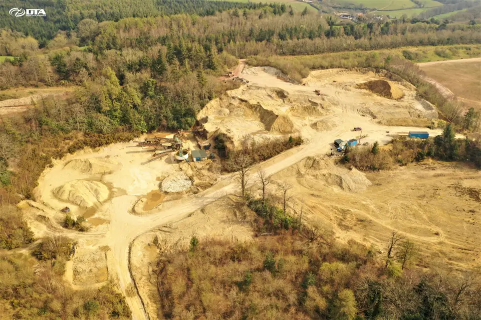
DTA works across the quarrying, aggregates and recycling sector, from straightforward aggregates sites to complex, mixed-material recycling stockpiles.
Quarry survey photography and models
Six views from DTA quarry surveys: the faces, plant and stockpiles we capture, and the model the volumes come from.
-
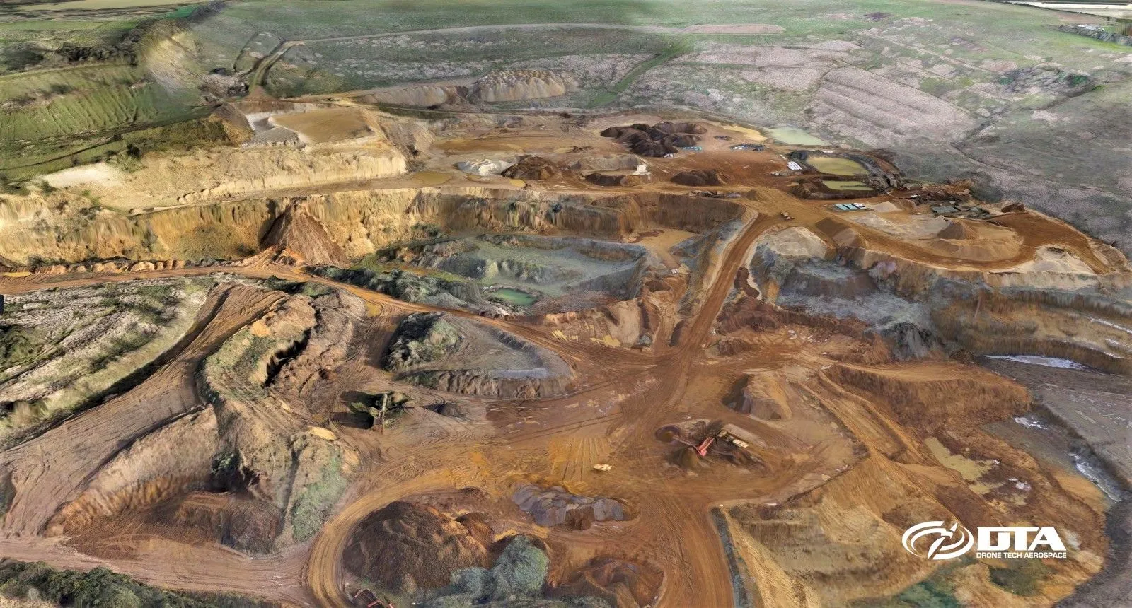
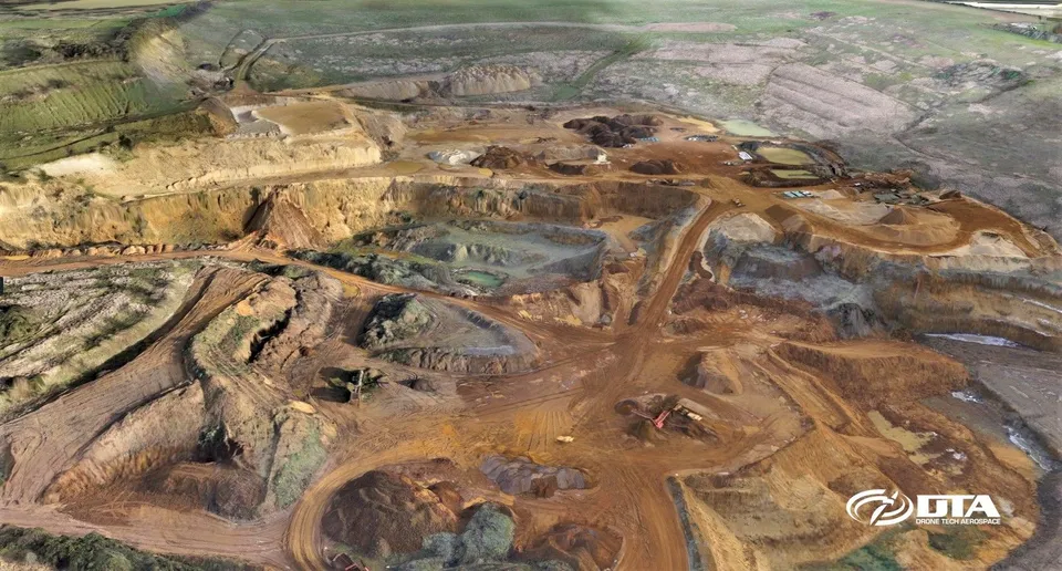
Sand and gravel quarry
Quarry Topographical Land Survey
DTA's cloud-based survey data delivery and analysis tools let engineers access and analyse results anytime, anywhere, from a simple PC, laptop or tablet via the web.
-
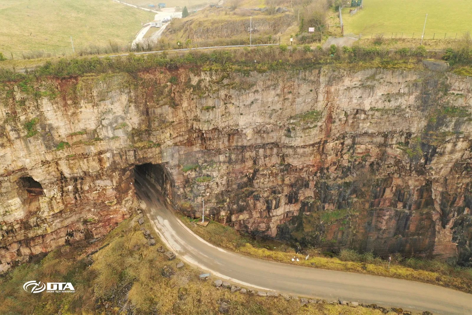
Hard-rock quarry (limestone)
Llanddulas road tunnel, aerial survey
Aerial photograph of a road tunnel at Llanddulas, North Wales, captured during a drone survey.
-
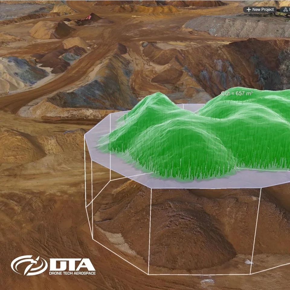
Volumetric model
Stockpile volume calculated on a 3D quarry model
A cut volume of 657 cubic metres computed over a stockpile in the 3D model produced from a drone quarry survey.
-
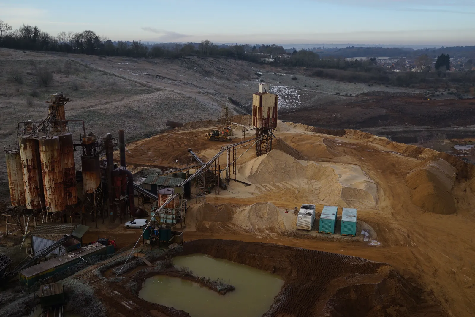
Sand and gravel processing plant
Sand and gravel processing plant at dawn
Drone view over a sand and gravel processing plant: silos, conveyor, washed stockpiles and the settling pond, captured during a quarry survey on a frosty morning.
-
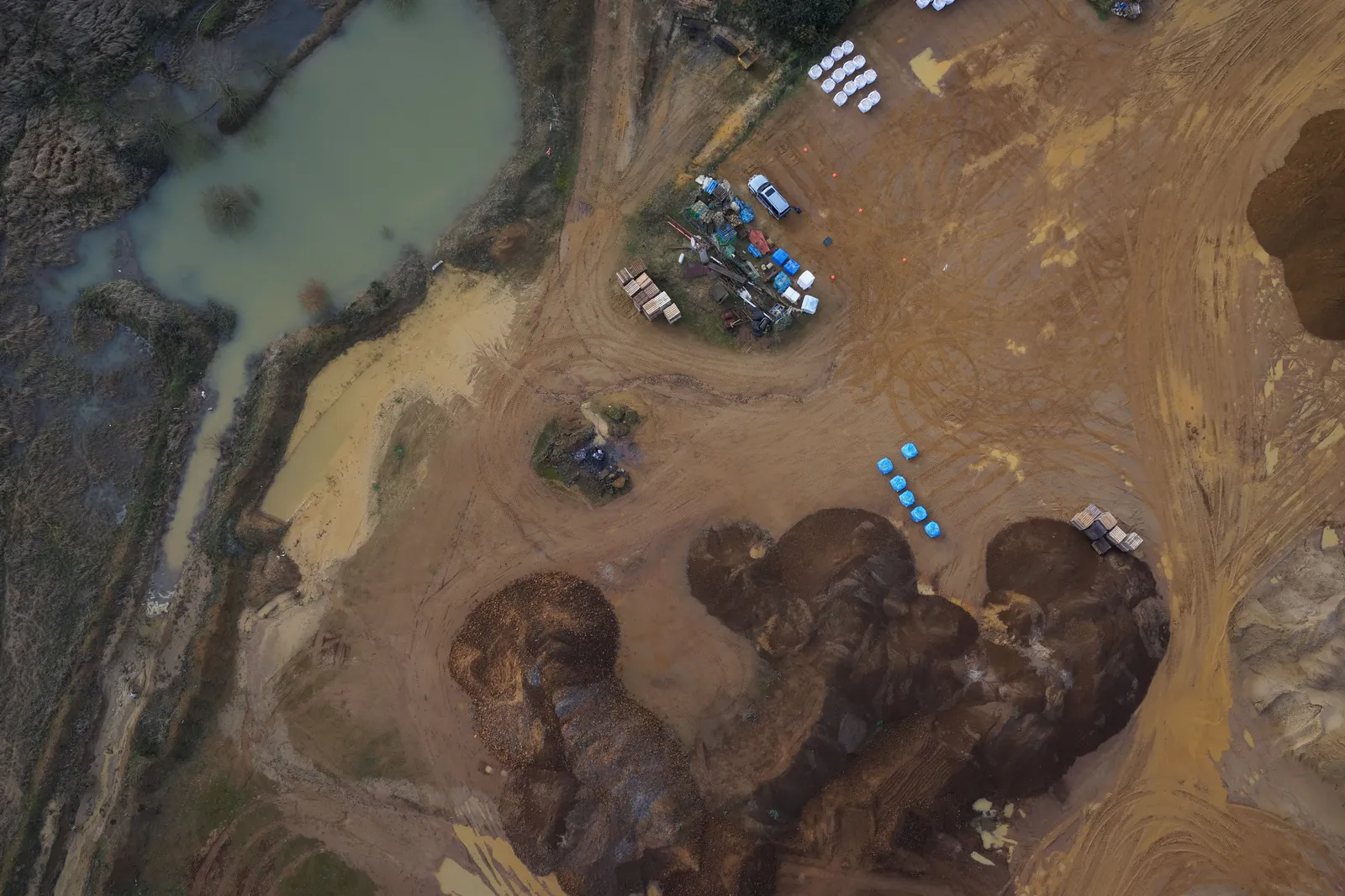
Stockpiles and lagoon
Stockpiles and silt lagoon from directly above
Nadir drone image of quarry stockpiles, the site compound and a silt lagoon, the viewpoint used for volumetric measurement.
-
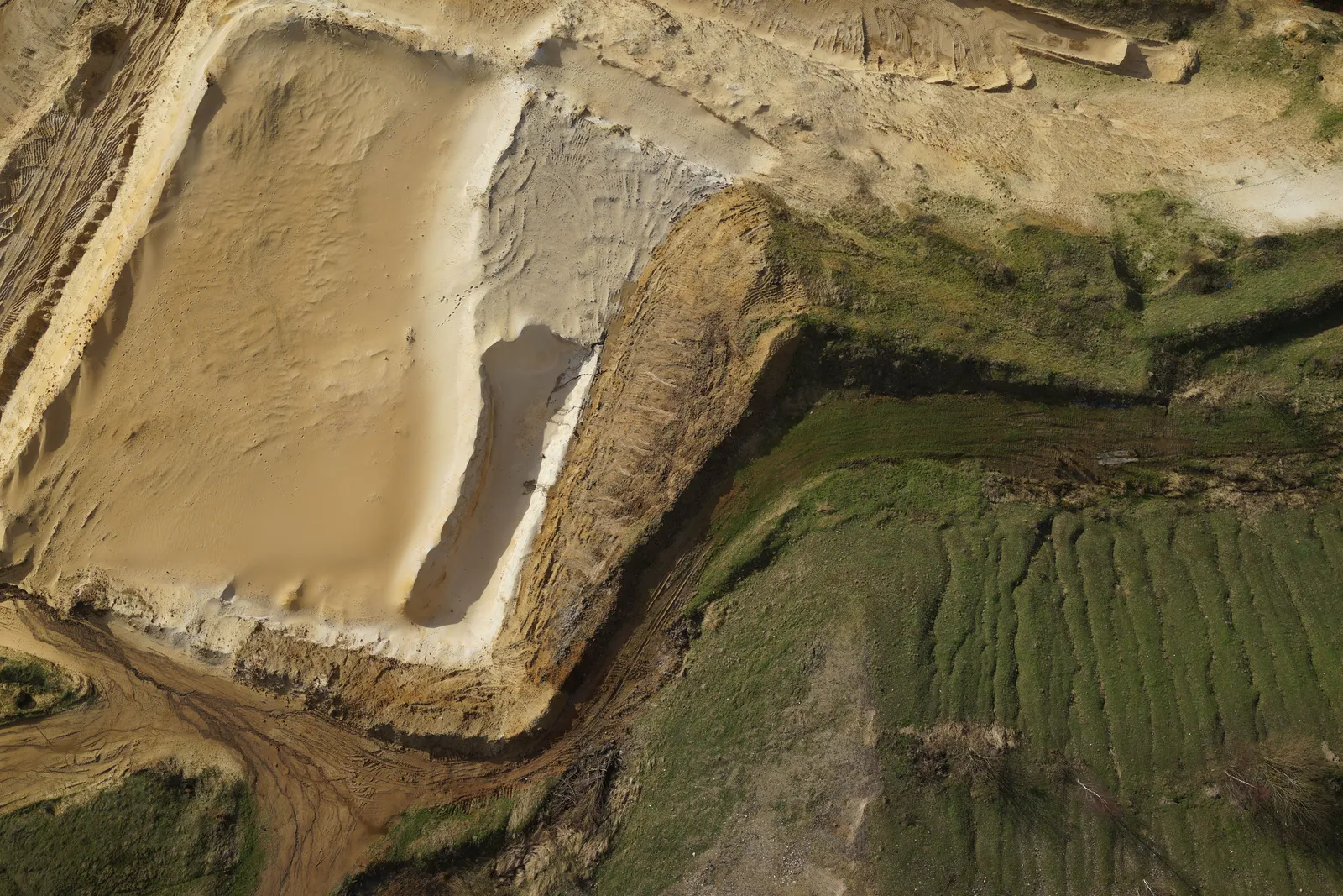
Extraction face and overburden
Extraction face and stripped overburden
Nadir drone image of a sand extraction cell with the stripped overburden bank and haul road, surveyed for face position and volumes.
Send us these six things
-
01
Site location / boundary
-
02
Required output
-
03
Intended use
-
04
Preferred timescale
-
05
Access / airspace constraints
-
06
Any existing drawings
Common questions
Can you calculate every stockpile on the site?
Usually, if each pile can be captured clearly and an appropriate base can be defined. Touching piles, material against walls, covered stock, vegetation and machinery may require agreed boundaries or exclusions.
Can you compare this month with the previous survey?
Yes, provided the surveys share a suitable coordinate basis and the reporting boundaries and method are consistent. DTA should confirm comparability before presenting a change figure.
What do you need before quoting?
Send the site boundary, required outputs, number/frequency of surveys, coordinate information, material types, any previous surfaces and site operating constraints.
See it in practice
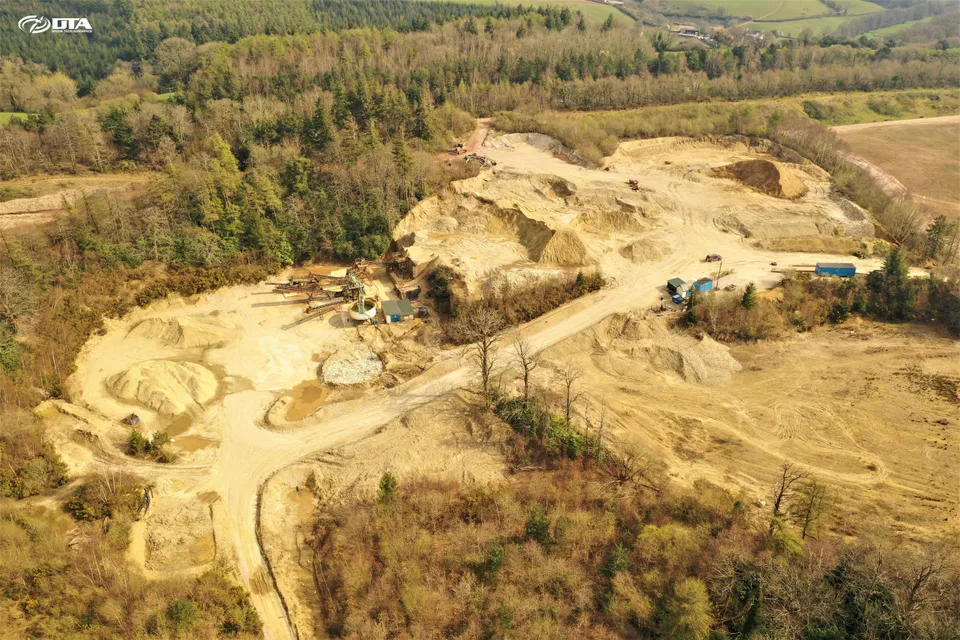
2 April 2020
Quarry Drone Topographical Survey, Devon
Another drone topographical survey of a quarry, completed safely in Devon during Covid-19 restrictions, drawing on DTA's long-standing technology lead in accurate drone topographical surveying.
28 January 2016
DTA's First Full Quarry Topographical Survey
DTA completed its first full quarry topographical land survey at Heath & Reach near Leighton Buzzard in January 2016, achieving a 1.7cm target GSD and 3.5cm post-processed accuracy.
Put repeatable data behind the quantities
Share the site boundary and the decisions the survey needs to support. DTA will return a clear capture, processing and delivery scope.
Request a QuoteTell us about your site.
Send the location and what you need. We'll come back with a clear scope and price.
Or we call you