

Roads · restricted airspace · no-fly locations
Elevated mast photography and video
A 4x4-mounted telescopic mast reaches roads, railways and restricted sites where drone flight permissions do not extend.
Facts panel
- Best for
- Roads, railways, busy public areas, flight paths and security-sensitive sites.
- Platform
- A 4x4-mounted telescopic mast carrying a stable, elevated camera.
- Typical outputs
- High-resolution stills, video and steady time-lapse or fixed-position coverage.
- Pairing
- Often combined with a drone on the same brief for full aerial and elevated coverage.
The mast complements DTA's drone fleet. Roofs, wind turbines, confined spaces and construction sites are still covered by drone wherever flight permissions allow.
Explore all drone inspectionsWhen a drone cannot fly, the mast still can
No matter how robust a drone operator's Operating Safety Case is, CAA flying permissions will always exclude certain locations: roadways, railways, busy public areas, flight paths and security-sensitive sites among them. DTA's 4x4-mounted elevated MAST reaches exactly those locations with a stable, elevated camera platform, delivering the same standard of photography and video coverage without needing a drone to fly.
- Roads and railways
- Busy public areas
- Flight paths and controlled airspace
- Security-sensitive sites
What DTA captures
The mast was added to complement, rather than replace, DTA's aerial drone work, so it can be scoped on its own or alongside a drone flight.
Stills
- High-resolution elevated photography
- Consistent, repeatable viewpoints
Video
- Steady, fixed-position coverage
- Time-lapse sequences over a monitoring period
Pairing with a drone
- Combined aerial and elevated coverage on the same brief
- One team, one point of contact
Proven on live highway and infrastructure sites
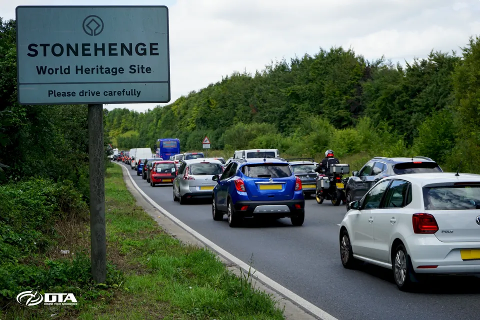
In August 2017, DTA was engaged by Copper Consultancy, working on behalf of Highways England, to monitor heavy summer holiday traffic on the A303 at Stonehenge. The team deployed a drone alongside the 4x4-mounted elevated MAST rig to capture the full picture, pairing the drone's flexibility with the mast's fixed-position capability, including steady time-lapse views that would have been difficult to achieve from the air alone. The elevated MAST photography and video service launched in May 2017, giving DTA a way to cover locations that drone flying permissions could not reach.
From brief to elevated coverage
- 01 Check the airspace. DTA reviews whether a drone can fly the site, or whether the mast is the right tool.
- 02 Plan the position. Vehicle access, road safety and the viewpoint the brief needs are agreed in advance.
- 03 Raise the mast. The 4x4-mounted telescopic mast is deployed to the agreed elevated position.
- 04 Capture. Stills, video or time-lapse are recorded to the required format.
- 05 Deliver. Footage and images are supplied ready for your team or production partner to use.
DTA supports infrastructure and utilities teams with elevated coverage of roads, rail and other restricted sites.
Send us these six things
-
01
Site location / boundary
-
02
Required output
-
03
Intended use
-
04
Preferred timescale
-
05
Access / airspace constraints
-
06
Any existing drawings
Where we have done this
- A303, Stonehenge, Wiltshire: drone and elevated MAST traffic monitoring for Copper Consultancy and Highways England (2017)
- UK-wide: launch of the 4x4-mounted elevated MAST photography and video service (2017)
Common questions
When do you use a mast instead of a drone?
When the location falls inside a flight restriction, such as roadways, railways, busy public areas, flight paths or security-sensitive sites, where CAA permissions do not allow a drone to fly.
How high can the elevated mast reach?
The 4x4-mounted telescopic mast raises the camera well above ground level to a stable, elevated position. Confirm the height needed for your site during scoping.
What does the mast deliver that a drone cannot?
A fixed, stable viewpoint for sites where drone flight is not possible, including steady time-lapse or fixed-position video that is difficult to achieve from the air.
Can you combine a drone and the elevated mast on one job?
Yes. On the A303 near Stonehenge, DTA paired a drone with the 4x4-mounted elevated MAST to give the client full aerial and elevated coverage of holiday traffic on the same brief.
What outputs does the elevated mast deliver?
High-resolution stills and video, including steady time-lapse or fixed-position sequences, to the same quality standard as DTA's drone media.
Do you still need a drone permission for a mast job?
No. The elevated mast is a vehicle-mounted, ground-based platform, so it can reach locations where drone flying permissions do not extend.
See it in practice
21 August 2017
Drone and Elevated MAST Traffic Monitoring on the A303
DTA deployed drone and 4x4-mounted elevated MAST photography and video services to monitor heavy summer traffic on the A303 at Stonehenge for Copper Consultancy and Highways England.
1 May 2017
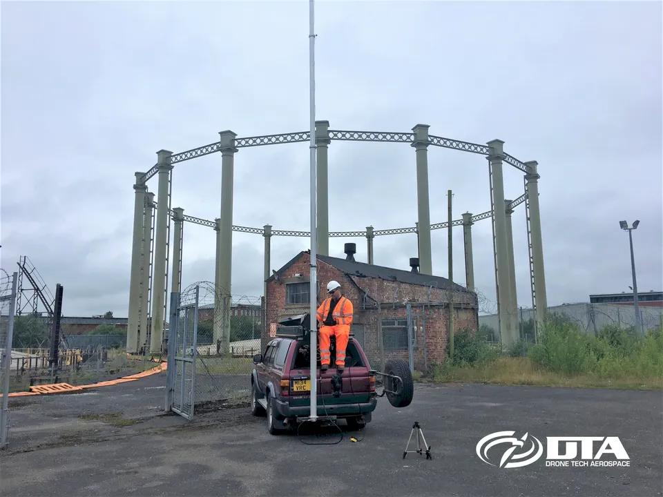
DTA Adds 4x4-Mounted Elevated MAST Photography & Video
DTA added 4x4-mounted elevated MAST photography and video to its services in May 2017, giving it a way to cover locations that drone flying permissions couldn't reach.
Get a clear scope and quotation
Send the location, the reason a drone cannot fly it, the required stills or video and any known access constraints, and DTA will confirm the approach.
Request a QuoteTell us about your site.
Send the location and what you need. We'll come back with a clear scope and price.
Or we call you